
Map Retrieval Intention Formalization and Recognition by Considering Geographic Semantics
Published in Journal of Geo-information Science, 2023
Abstract
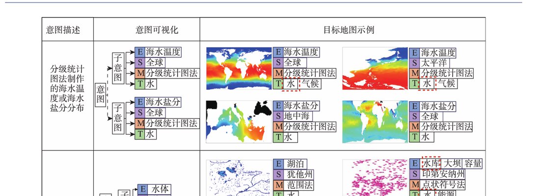
Mainstream map retrieval methods for spatial data infrastructures are mainly based on metadata text matching or image similarity calculation, but such approaches lack active perception and understanding of user retrieval intention, and in turn fail to truly meet user requirements. While, existing intention recognition methods are incapable to express and recognize map retrieval demands with joint constraints of complex geographic concepts. To address this issue, this paper proposes a map retrieval intention formalization and recognition method by considering geographic semantics, aiming to improve the accuracy of map retrieval in an intention-driven and explainable manner by using relevance feedback samples. More specifically, a formalization model constrained by geographic ontology in the form of “intention–sub-intention–dimension component” is designed for expressing user’s map retrieval intention. With the support of the formalization model, a recognition algorithm based on minimum description length (MDL) principle and random merging (RM) strategy, named MDL-RM, is proposed by treating intention recognition as a combinational optimization problem. MDL-RM takes the description length of the sample set from relevance feedback as the optimization goal, and merges samples randomly with the assistance of geographic ontologies and semantic similarities among geographic terminologies to generate sub-intention candidates, and searches the optimal intention using a greedy search approach. In order to evaluate the accuracy of recognized intention, we proposed a semantic metric, named Best Map Average Semantic Similarity (BMASS), and calculate it along with Jaccard index in five typical map retrieval scenes. Meanwhile, we analyzed the time cost and the influence of parameter settings, and validated the effectiveness of random merge and sample augmentation strategy. The experimental results on the synthetic data demonstrate that the proposed method has higher accuracy and sample noise tolerance in most retrieval scenes comparing with the method based on Gene Ontology (RuleGO) and the decision tree learning method with hierarchical features (DTHF). Random merge strategy can reduce average computing time effectively without declining accuracy, and sample augmentation strategy facilitates retrieval intention recognition even when the sample size is as low as 20. The proposed method is expected to be adapted and applied into geoportals and catalogue services to improve the service quality and user experiences upon the sharing and discovery of geographic information resources.
Gui, Z., Hu, X., Liu, X., Ling, Z., Jiang, Y., & Wu, H. (2023). "Map Retrieval Intention Formalization and Recognition by Considering Geographic Semantics." Journal of Geo-information Science, 25(6), 1186–1201.